• PARTNER: PROTECT YOUR WATERS
  • Go To: THE FLIES OF YELLOWSTONE
  • Go To: YELLOWSTONE FISHING WEATHER
  • Go To: YELLOWSTONE FLY FISHING MAPS
  • Visit: Moldy Chum
  • Visit: The Horse's Mouth
  • Visit: Chi Wulff
  • Visit: Parks' Fly Shop
  • Showing posts with label Fishing Map. Show all posts
    Showing posts with label Fishing Map. Show all posts

    Thursday, January 25, 2018

    Small Update

    NEW OWNERS
    New Signs
    less feather merchants
    FEATHER MERCHANTS OF WEST YELLOWSTONE
    -------
    NEW SIGN IN TOWN


    .. The recent amalgamation of feather merchants in our little village requires a new map.
    .. We figure that a town with twice as many pubs as fly shops and, more fly shops than churches deserves it's very own map.
    .. Click on the map to see original and then save it to wherever you like.
    -----
    .. The snow is coming back this afternoon.  It's going to be warm enough to bring us another dump of the wet stuff rather than the dry stuff.
    .. Breakfast was early and there's time for a quick dash to NOTELLUM CREEK ESTUARY. The midges are swarming in the morning sun. Off we go.
    ------- 
    WALLPAPER:  OVEN BBQ RIBS - YUM !

    Saturday, December 29, 2012

    21 Weeks & Counting

    NOT TO RUSH THINGS - BUT
    Plan To Include Reservations
    off the road is good for the soul
    EARLY CATCHING SEASON ON THE FIREHOLE RIVER - A SOCIAL EVENT
     
    -------
    .. Just a thought. There are some spectacular places to fish in Yellowstone National Park that are less than a mile from a paved road. Most fisher folks don't even think about them. That's fine with us.
    .. Some of the absolute best catching of trout in Yellowstone National Park is not on the Firehole River, or the Madison River, or the Gibbon River, or the Gallatin River.
    How many can you catch?
    .. It might be on Slough Creek, but not where the elbows are. It might be near the Lamar River, but not within sight of the road. It could even be in the mosquito ridden Bechler Region of the park.
    .. Most fly fishers are of a gregarious sort. Yet, they whine about too many folks on their water. They sob about the fact that there are even other folks on their water. They bemoan the fact that someone found their secret spot. Go figure.
    .. Then they return to the same holes on the same rivers and wonder why things have not changed.
    .. Most of the glory waters in Yellowstone National Park are about comfortable fishing. Do it the way you have read about it. Do it the way the counter help at a feather merchant's shop tells you to do it. Listen to the guides as they extoll the virtues of their successful outings and the grins on their client's face. It's comfortable. Go where you've been before - it's comfortable. Go where someone told you to go - it's comfortable.
    .. Most fly fishers measure their fishing experience in terms of the fish that were caught. A few in terms of the bugs or the rivers. Very few, (we plead guilty,) in terms of the place, the time, the surroundings, or the weather - fish be caught or not.
    RUNNERS IN THE FALL - UNFISHED PARADISE
    .. We encourage all fishers that come to Yellowstone National Park to engage in comfortable fishing.
    .. Measure your experience in terms of the size of the fish, the number of fish, the various species of fish, the beauty of the fish, the strength of the fish - enjoy the fish.
    .. You will have the memories of having fished and caught fish where millions of other fishers have fished and caught fish.
    .. You will be able to tell stories of the same parking places, rocks, runs and riffles and pools that others have experienced. It's fullfilling to be part of the club.
    .. We do not suggest that you spend any time in the winter looking at maps. We do not suggest that you plan to walk too far or explore the thousands of miles of streams and rivers in Yellowstone National Park. We do not, for an instant, suggest that the local, professional, experts are not omniscient or omnipotent - heaven forbid! After all, they make a good living by being the way that they are. It's comfortable.
    .. We, silly us, are spending many hours this winter looking at maps. We're looking at Google Earth. We, at the moment, are comfortable. But it's not fishing. We are planning a summer of distinctly uncomfortable fishing. Catching may accompany it: may not too.
    .. Resources for the uncomfortable fisher folks are wide and varied. Google Earth is good. Digital-Topo-Maps[dot]Com is exceptional and lets you print the maps you need - it's free! Searching the various "YELLOWSTONE FISHING" web sites gives many insights that even the local experts have not yet discovered. Most of this "research" is butt-time, in front of a computer, we hope it pays off.
    .. Last year, Many of the wader friendly lodgings in town were booked well in advance of the fishing season in the park. The owners of these establishments have developed a following of repeat customers and suggest that it's never too early to grab your place. Of course there are over 3,000 motel rooms in town - BUT - not many have facilities for drying waders, tying flies, and other things that gregarious fishers enjoy.
    .. Right now, by gum, the sun has made an appearance, so we're getting off our butt - for the moment.

    PRINTABLE TOPO MAPS FOR FREE
    ..
    -------
    HOW BIG OF A BROWN TROUT DO YOU WANT?

    Wednesday, June 30, 2010

    Google And The Gallatin

    VERY COLD CLEAR WATER
    Hidden Meadows & Fish
    it's nicely off the road

    -------
    .. Just what is the Upper Gallatin River?
    .. Some would have it as everything above Taylor Fork. Some would have it as everything above Gallatin Gateway. Some would have it as everything above 4-Corners.
    .. We tend to think of the Upper Gallatin River as that portion above the Highway 191 Bridge, (or thereabout,) in Yellowstone National Park.
    .. It's just a matter of perspective: not being fluvial geologists, we feel free to call 'em as we like 'em.
    .. It's in the confluence meadows, just above the bridge, that Fan Creek, Bacon Rind Creek, and the Gallatin River join.
    .. It's here that the water is cold and crystal. It's here that the moose winter and the bears hibernate. It's here that few visitors bother to fish. We like it all.
    .. The three creeks are each born in glacial cirques. All are associated with the remnants of cirque lakes. The Gallatin River finds it's origin in Gallatin Lake, (the NPS keeps this lake to themselves and restricts travel to the trail only - as if the bears care.)
    .. The rivulets of the three creeks start above timberline and coalesce down-slope in a series of gradient changes that make for some wonderfully surprising meadows and equally surprising fishing opportunities.
    .. For us, some of the meadows haven't been seen in over 40 years. But, with the aid of Google Earth and old photographs, we can revisit the cherished memories. And of course plan where to visit on those days that the legs are up to it.
    .. The fidelity of the images, generated by Google Earth, to the ground truth is astonishing for such a wonderfully free product.
    .. Given this fidelity, and a U.S.G.S. topographic map it is possible to explore and anticipate your next escape.
    .. Brownliners and blueliners already know this. We are just now discovering how useful it is.
    .. Our current silliness involves updating our Yellowstone Fishing Maps on Google Maps. It's a wonderful tonic for insomnia.
    .. As part of this project we started taking some more pictures of the various locales. So, a kindly neighbor suggested, (expletive deleted,) that all that pointing and shooting was unnecessarily burdensome and tedious.
    .. He suggested that the Google Earth renditions would be more than adequate - and perhaps preferable because visitors could just go to the coordinates in the Google programs and discover the area for themselves. Why didn't we think of that?
    .. There will still be photos from our trusty point & shoot, after all we do need to check and see if the rivers are still there.
    -----
    .. The first river being mapped and plotted with juicy fishing locales is the Gallatin River in Yellowstone National Park.
    .. The interesting thing about the imagery of the Google programs is that it can be severely out of date.
    ..The examples shown in this post have imagery from as far back as the 80's. The landforms are recognizable and can be duplicated with a photograph.
    .. The river courses, (dynamic beasts,) are in some instances quite different. Happily, The major river segments have maintained their character over the decades.
    .. So from time to time we'll be posting some images from the mapping project.
    .. Naturally, it'll go slowly when there's catching to be had. It should progress more rapidly this winter.
    -----
    .. The Gallatin River has come into it's own. It continues to warm and the fisher folk are doing less dredging and a bit more floating with their bits of fluff.
    .. Your favorite attractor will do for surface fare.
    .. We like Royal Coachman and Adams, sizes can go to 8 or 10 for now. Even the little fishes will attack a high floating fly of whatever ilk - for the moment.
    .. Fish the deep slow pools and undercuts in the morning with a Soft Hackle or small Woolly Worm.
    .. Use a nymph; Bead Head Caddis, (or Prince,) during mid day in the riffles & at the heads of pools or the seams in bends.
    .. As the shadows from the mountains creep over the river go up to the top and pound some noses.

    -------
    .

    Sunday, June 15, 2008

    Fisherfolks Guide To West Yellowstone

    A START FOR YOUR VISIT
    The Basics
    .. location, Location, LOCATION. The Map below will give you some help in navigating the town. During the Summer it's a surprisingly crowded place.
    .. Enormous condominiums on wheels park in the center of the street. Children chase each other through red lights, visitors walk in the middle of the street, drivers stop and start for no apparent reason, "U-Turns" are common and unannounced, panic stops in intersections are the rule, parking is nonexistent. It's best to park and do it on foot.
    [[ Click on the map for larger, printer friendly image ]]
    ----------
    -- The Fly Shop Map --

    1. Blue Ribbon Flies
    2. Madison River Outfitters
    3. Bud Lilly's
    4. Arrick's
    5. Eagle's Fly Shop
    6. Bob Jacklin's
    7. West Yellowstone Fly shop

    Wednesday, May 07, 2008

    Mapping Underway

    JUST A FEW MORE FISHING LOCATIONS
    SHORT BUT SWEET
    .. We've added some places on the Gallatin River - (Grayling Creek,) Gibbon River, and the Madison River outside of Yellowstone National Park.
    .. The Grayling Creek locations are on the Gallatin River map because of their proximity and access points. They will also be included on the Madison River map.
    .. The general map has been skewed by a visitor who place a location somewhere between Shafer and Hannahsville in West Virginia. It looks rugged and "Trouty" but it's not Yellowstone. As soon as we figure out how to remove it the base map will be back to an easily navigable size.
    .. So far there have been over 1,000,000 visits to the maps. This is growing by somewhere between 200 and 500 per day at the present time.
    .. For access to all maps individually go to "YELLOWSTONER'S MAPS."
    .. For access to the suite of maps click the map page link in this page's header.

    Friday, March 14, 2008

    Just A Little Horn Tooting

    MAPS ARE US
    More To Come
    .. A couple of years ago we received several requests for an annotated map of fishing places in Yellowstone National Park and the area around West Yellowstone. We discovered PLATIAL and started mapping - not as religiously as we had hoped, but we stuck with it.
    .. There are now about 150 places where we have "placed a pin on the map." They are not secret, they are not exceptional, they are not hidden: they are just good places to fish.
    .. The statistics for our MAP PAGE rival those for this Blog Page. We're pleased that the maps are useful and that they receive such strong visitation. This season we will add another 100 or so places and expand the photos and annotations for each spot. It's less work and more fun than it sounds.
    .. A few months ago Platial and Frapper teamed up to provide the largest mapping service for both people and places. There are now over 46 million places and over 90 million people mapped in all sorts of categories from social movements, to biking trails, to pizza shops to video stores, to photo opportunities, to activism ----- and of course places to fish.
    .. Imagine our surprise when an innocuous looking email appeared from Platial. We opened it and found that we had won first place in the "Local Guide" category. We are humbled, and of course just a bit pleased.
    .. Take a moment to scan the winners in the various categories HERE. If you'd like to provide Platial maps on your website or blog you can sign up HERE. If you want to search the categories and maps, click HERE. There are over 50 Platial Fishing Maps. Click HERE to sample them.
    .. Should you choose to take advantage of this service; be advised that the Platial staff is composed of real people that answer your emails, provide guidance, and serve as an exceptional resource for your mapping efforts. We hope they all become millionaires and sleep well. These are sterling folks of the first water. You can follow the happenings at their Blog - HERE.
    secret fishing spot
    photo courtesy of
    The Reverend Payton's Big Damn Band

    Tuesday, August 21, 2007

    Little Waters & The Weather

    BELIEVE THE FORECAST ?
    Then Get Ready
    .. If Yellowstone National Park adheres to their Drought Fishing Restriction Strategy (PDF) which is: 1) Stream flows decline below long-term averages, and/or 2) Stream temperatures approach 73ºF (22.7ºC) for extended periods. Then we anticipate that one criterion will be eliminated this week. The historically low flows will not not be alleviated until more rain is in the forecast. The official announcement of any change will be posted on the YNP News Releases page.
    .. Keep an eye on the weather from NOAA, and plan your fishing accordingly. Leave the Firehole River alone for the rest of the year. Visit with the local fly shops (links in sidebar,) for information when you arrive. Be sure that you have early 'wader friendly' lodging reservations.
    .. Fishing in the neighborhood has been pretty good considering the conditions.
    .. The Gallatin River continues to be a worthwhile proposition; both in the park and further downstream. Localized afternoon showers have produced some off color days but the neighbors continue to explore this river as a first choice. There are still a few hoppers and spruce moths in the park sections. Evening Caddis hatches are holding up fine and there are even some PMD's holding on. Late afternoon is best for surface action. Fish all day with a hopper-dropper combination and you should do fine. Drop a Prince Nymph or a Feather Duster: use your favorite hopper in sizes 8 - 12 and it may fool a few as well.
    .. The Madison River between the lakes is very crowded - justifiably so. The cold tailwaters continue to attract fish and fishers alike. Some very good fish, (18" - 22",) have been taken in the Discharge Riffles on streamers, (dark olive woolly buggers and dark spruce flies: sizes 4 - 6 3xl.) Good nymphing is to be had at Campfire Run, and some excellent evening Caddis is available between Choice Hole and Awkward Bend. Fishing this section of the Madison River gives on a chance to observe both out of state license plates and etiquette.
    .. Gulpers are still on the menu for Hebgen Lake. Get up early and hit the water about the time that the sun has been on the lake for an hour or so. Callibaetis spinners seem to be the item of choice, (size 16 - 20.) There have been a couple of reports that Yellow Woolly Worms in size 12 - 14 have taken fish in the South Fork Estuary - worth a try?
    .. The upper Gibbon River continues to provide great entertainment with eager fish of the smallish variety. The water adjacent to the Norris campground is hammered pretty hard, but the One-Cast Meanders still harbor eager Brown and Brook Trout. Beware of the large solitary bison in these vest pocket meadows and enjoy fishing with a 3-weight. Big fish can run to 10" in this bit of water.
    .. Further up the Gibbon River in the meadows above Virginia Cascade and around Wolf Lake your 3-weight will be well exercised by some wily and energetic Rainbows and Brookies to 16" or a bit more if you're lucky. All of this fishing is best done with small terrestrials and a few nymphs, (float them or sink them at your pleasure.)
    .. When it's clear Soda Butte Creek is fishing very well indeed. Generalized surface flies will work in the water below Canyon's End and the larger pools below the Pebble Creek confluence. Yellow Humpy, Adams, and Elk Hair Caddis will all do well. Keep the flies on the smallish side: 12 - 18 will be the ticket. Small beetles and ants should be in your box too.
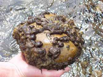
    .. Rock Snot has a new name: "Sea Snot," ( 1, 2, 3, 4). Protect Your Waters lets us know about an article in The New Haven Register that details the current evolutionary adaptations of this menace. And: "Lately, it has been expanding its range and changing its preferences for low-temperature, nutrient-poor, water." This does bode well for the high country waters that the neighbors enjoy.
    ----------------------
    MAP NOTE: Additional locations have been added to the maps. To view the locations maps by river segment go to YELLOWSTONE FLY FISHING MAPS, to view all locations go to Yellowstoner's places @ Platial. The seven maps, (more to come,) have been viewed a total of about 5,000 times in 4 months.
    .. Upcoming maps will include: Regional & Local Fly Shops, Good Grits, Watering Holes, etc.

    Monday, June 25, 2007

    Maps-4-U

    MAPS - SLOW BUT STEADY
    Flies Too

    .. The Yellowstone Fishing Maps have multiplied to a total of nine, (maybe 10 by the time you read this.) Each will, in the near future, become a page of it's own. The plan is to have a fishing guide with maps for the most accessible and productive waters in Yellowstone. It's a huge undertaking and will take longer than anticipated - fishing is more important than blogging in this bit of geography.
    .. The Flies of Yellowstone page is coming along too - much more slowly. Apologies are in order to the folks with dial-up connections . . . the maps are a pain, and the photos on the flies page are not of a uniform format. Winter should produce cleaner pages for next season.
    .. The links in the upper left corner of this page will take you to the maps and flies.


    Thursday, May 31, 2007

    Field & Stream Copies Yellowstone


    .. Mid Current has let the cat out of the bag. Fishing maps are the wave of the future and soon even the "secret" places will be well known - as if they aren't already. The functionality of our maps include: the ability to search for locations, add local names, and download the data base - you can literally make your own map from ours - enjoy.
    .. We hope that Field and Stream will catch up soon. We're pleased to have pioneered this innovation. Watch it spread.

    -------------
    PS - Everything that you've heard about the fantastic fishing in Yellowstone, (particularly the Firehole River,) is true. PMD's are prolific and on schedule, Baetis are peeking out and getting thicker, stoneflies are beginning to pop, several kinds of caddis are already apparent, and there is no bad place to fish. Mega-report tomorrow for the weekend.

    Saturday, May 19, 2007

    Yellowstone Fishing Maps Online

    TRY THESE MAPS
    It May Take A Couple Of Years

    .. We've had some positive reactions to the map at the bottom of the page. We've had some other reactions too! So we decided to place the maps on their own page. You can access the fishing maps by clicking on the link at the upper left corner of this page.
    .. In time, (who knows how long?) we intend to have maps for all major river segments in Yellowstone National Park.
    .. For now, the maps will be keyed to the blog posts as we go along. Only first hand information will be included. Of course the blog information will be date sensitive - the map information; less so.
    .. For those of you interested in the technical details and the services provided by Platial you can check their blog or the new sites page.
    .. Some really fine mapping tools are becoming available to the blogger with geographic information to share. One of the finest examples in Yellowstone is the Yellowstone Back Country Camp Sites map produced by Walking Shadow Ecology.
    .. This map includes all of Yellowstone's back country camping sites on a 3-D topographic layer on top of the Yellowstone topographic map, showing roads streams and trails.
    .. The combined resources of Google Earth and discrete location data can be mapped through various layers for both presentation and research.
    .. Nothing so elegant here though; just a few good places to fish and a description of some of th flies and techniques that work.
    .. Try it out: GO TO YELLOWSTONE FISHING MAPS.