ANOTHER FOOT OF FLUFF
Still Not Enough
.kmz files show it all
-------
 .. Well, it's nice to see some more snow. And, it's nice to see even a
  little more in the forecast. BUT - we're still at just 77% of average .
.. The snow-water-content may be even lower, including this bit of fluff, when it gets measured.
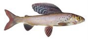
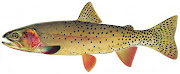
.. We fished a bit at the Quake Lake Outlet over the weekend: stumbled through the boulder field, barked our shins, watched our blood freeze, and caught some monsters.
.. We did it almost like the worm fraternity. They are not above using a fly to catch some.
.. They've taken to adding a Hornberg to their worm rigs. We rigged ours without the garden hackle.
.. A slow sink-tip line with a 5-foot chunk of 10# Maxima and a #8 Hornberg allowed us to cast to the ice, pull the fly into the water and let it sink deliciously to waiting maws of a herd of finny denizens. Great fun.
-------

 .. It's as if we could do something about it!
.. In the Spring we watch and worry and speculate about the snow pack and the runoff and the upcoming fire season.
.. Where's the snow? How much? How's it compare
 to previous years? Will the Spring rains bring it all down at once? What are the best mud flies?
.. It's a constant topic at the pub, the market, the post office, the hardware store, and church.
.. Well, informed neighbors are watching the NCRS sites with avid interest.
.. These sites have expanded their products with a series of .kmz files. These are Keyhole Markup Language files that allow the use of Google Earth to visualize the current conditions.
.. It's possible to overlay several .kmz files for added information. The files are produced by the NCRS in conjunction with the NWS: they are current, and graphically interesting. The data is precise too.
.. We pulled up a few for the Western United States and the Yellowstone Plateau.
.. The images below are screen shots of the images. Just click on any image to go to the appropriate page to get your own .kmz file.
.. Once you get the file downloaded, just click to open it and Google Earth will present you with the image, (Internet Explorer and Safari users need special instructions which are given on the download pages.)
.. The files are interactive and by clicking on the data points a range of information is presented in tabular form for your edification. Makes for great conversation while waiting for the butcher to trim your crown roast.


 .. It's best if your computer is fairly competent and your Internet connection is rather quick. Some of the files include enormous amounts of embedded data and can take some time to load.
-------
.


.jpg)