RECENT SNOWS IMPORTANT
Cool Weather Helping
new usgs resources


-------
 .. The recent, (local,) two feet of snow is reflective but not indicative of our snow water equivalent.
.. Mom is doing her best to recover some of the snow pack necessary for healthy
 stream flows for the neighborhood.
.. The jury is still out on what conditions for mid and late summer will prevail.
.. Right now, however, the cool weather has kept stream flows below normal for this time of year.
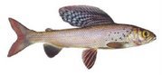
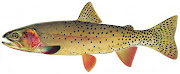
.. This makes for exceptionally good fishing and catching in the neighborhood around Yellowstone National Park.
.. Also, the USGS has recently completed their WATER WATCH mapping and database integration. It is now possible to view 'real-time' discharge data in the form of interactive stream flow maps.
.. Data is available for all of the United States, and it's possible to create customized regional maps with just a few clicks of the mouse.
 .. All maps, (standard or customized,) allow for interactive participation. Just hover the cursor over a river gauge and a note pops up with details about current and historic flow, (see image at bottom of post.)
.. These maps are integrated with the Google Maps and all features of that database can be utilized: terrain, satellite, hybrid, zoom, etc.
.. The USGS also compiles an integrated map of all stations in Yellowstone National Park. The 15 pertinent stations each has its own searchable database.
RESOURCES:
==> USGS WATER WATCH HOME PAGE==> USGS WATER WATCH MONTANA PAGE
==> USGS WATER WATCH IDAHO PAGE
==> USGS WATER WATCH WYOMING PAGE
==> USGS YELLOWSTONE STREAM FLOWS
.
-------
.


.jpg)