• PARTNER: PROTECT YOUR WATERS
  • Go To: THE FLIES OF YELLOWSTONE
  • Go To: YELLOWSTONE FISHING WEATHER
  • Go To: YELLOWSTONE FLY FISHING MAPS
  • Visit: Moldy Chum
  • Visit: The Horse's Mouth
  • Visit: Chi Wulff
  • Visit: Parks' Fly Shop
  • Showing posts with label NOAA. Show all posts
    Showing posts with label NOAA. Show all posts

    Wednesday, March 29, 2017

    The Return

    NITROGEN FROM SKY
    NOAA Note
    we're pleased
    WALLPAPER:  BIT OF NITROGEN
    -------
    .. Seldom mentioned is that snow brings more captive nitrogen to the ground than does rain or any other form of precipitation.
    .. The last couple of warm weeks have removed snow from the dark masses in town: house roofs, streets, exposed car roofs, and south facing raised bed gardens.

    GREEN WONDER
    .. We're anticipating the planting of the early spring crops.
    .. The forecast late snow storm for the next couple of days will give us the shot of nitrogen that early crops enjoy.
    .. Fishing will be good - catching should be great.

    NOTE FROM NOAA
    Event:

    Winter Storm Watch
    Alert:
    ...WINTER WEATHER RETURNS TO HIGHER ELEVATIONS OF SOUTHWEST 
    MONTANA THURSDAY AND FRIDAY... 
     
    .Travelers through higher elevations of Southwest Montana should 
    prepare for the potential for periods of moderate to heavy 
    precipitation late tonight through Friday morning. For higher 
    elevations of southwest Montana, this will rain changing to snow 
    as snow levels gradually drop from 7500 feet tonight to 5500 feet 
    Thursday night into Friday morning. Areas most impacted will be 
    above 6500-feet elevation, where moderate to heavy snow may fall 
    at times. Between 5500-feet and 6500-feet, minor snow 
    accumulations will be possible especially Thursday night through 
    Friday morning. 
     
    ...WINTER STORM WATCH IN EFFECT FROM LATE TONIGHT THROUGH FRIDAY 
    MORNING FOR ELEVATIONS ABOVE 6500 FEET... 
    The National Weather Service in Great Falls has issued a Winter 
    Storm Watch For elevations above 6500 feet, which is in effect 
    from late tonight through Friday morning. 
     
    * Locations: Big Hole Pass, Chief Joseph Pass, Monida Pass, 
    Raynolds Pass, Targhee Pass, and West Yellowstone. 
     
    * Timing: Beginning late tonight toward Big Hole and Chief Joseph 
    Pass, and then spreading east Thursday evening through Friday 
    morning. 
     
    * Accumulations: Snow accumulation of 3 to 5 inches possible, with 
    6 to 12 inches possible toward Big Hole and Chief Joseph Passes 
    in western Beaverhead County. 
     
    * Winds: North 10 to 20 mph with gusts up to 30 mph. 
     
    * Visibilities: Possibly reduced to one-quarter mile at times in 
    heavier snow. 
     
    * Hazard Elevation: For elevations above 6500 feet. 
     
    * Snow Level: 7500 feet Wednesday overnight lowering to 5500 feet 
    Friday morning. 
     
    * Impacts: Periods of moderate to heavy snow may significantly 
    impact travel.
    -------
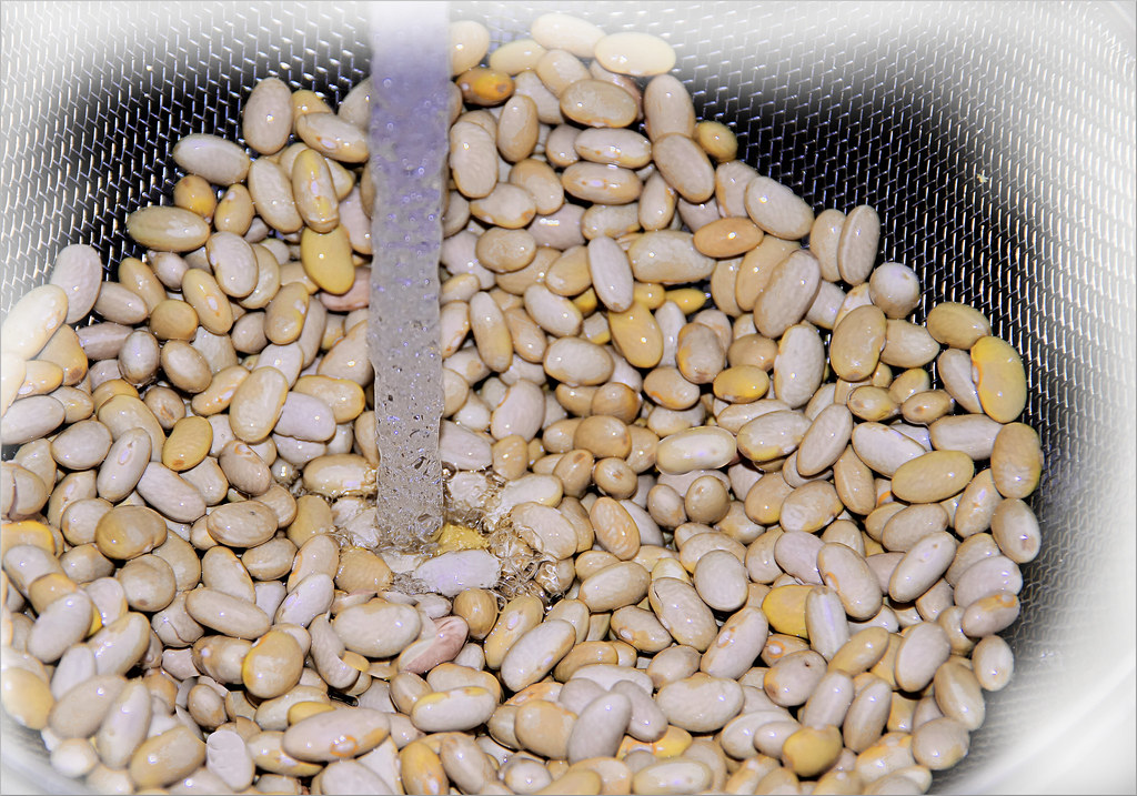
    WALLPAPER:  MAYOCOBA BEANS: (Phaseolus vulgaris)

    Tuesday, December 18, 2007

    Google Your Water Supply

    NRCS BUILDS ".kmz" DATA FILES
    See Daily SNOTEL Data For Your Waters
    (click image to enlarge)
    .. Should you ever want to know how your snowpack is doing you can get it done with a new visual mapping tool developed by the Natural Resources Conservation Service (NRCS.)
    .. There are two ways to display this information on your computer. 1] if you're a computer mapping junkie, you can download the ".kmz" file and display it on your computer's copy of Google Earth, or --> 2] you can go to the NCRS site and view the daily image.
    .. The data base includes all NCRS SNOTEL sites for North America, and can be viewed either with, or without labels for the sites.
    .. There's nothing that we can do about the results of the weather, but now we can see and talk about it in real time.
    .. The data files are updated daily around 7:30 am and 12:30 afternoon Pacific Time with midnight summaries of the previous day’s data. The symbols are color-coded by the current snow water equivalent as percent of the 1971-2000 normal on this date.
    .. The ".kmz" file is recognized on your copy of Google Earth as "places." If you click on the site of interest you will get a photo of the site and a summary table for the data collected at that site. There are additional real-time reports included in the information on the photo page.
    .. There is also a Google based "Water Supply Forecast" data base created by the NCRS. This is displayed in the same way as the SNOTEL data and can be viewed both ways as well. The forecasts are based on the snowpack, and are available for drainage basins.
    ---------------
    .. Another pair of Google ".kmz" files has been prepared by NOAA. These are 3-D overlays of the snowpack analysis and snow reports. These are based on the latest, (usually daily,) NASA and NOHRSC imagery.
    .. Here are the links to get you started, (P.S. you can build your own ".kmz" file.)
    Google Earth SNOTEL Data Layer
    Google Earth Water Supply Forecast Layer
    National Snow Analyses 3D Interface
    ---------------
    .. Here's one for Tom, (click for data.)