FLOODS COME UP
Watch Not Warn
perhaps it's spring
 |
| GREAT BASIN HIGH EXPANDS |
-------
>HERE COMES THE WARM<
| Event: | Flood Watch | ||
| Alert: | ...FLOOD WATCH IN EFFECT FROM 3 PM MDT THIS AFTERNOON THROUGH WEDNESDAY AFTERNOON... The National Weather Service in Great Falls has issued a * Flood Watch for a portion of southwest Montana, including the following areas, Broadwater, Gallatin, and Jefferson. * From 3 PM MDT this afternoon through Wednesday afternoon * Minor flooding is already occurring across portions of this region. However, with afternoon temperatures expected to be around 50 degrees over the next few days, the flooding could become more widespread and impactful. * With frozen ground surfaces and waterways, combined with culverts and ditches full of snow, poor drainage of the snowmelt is possible, causing some flooding impacts. Additionally, unpaved roads will become muddy, possibly becoming impassable for some vehicles. | ||
| A Flood Watch means there is a potential for flooding based on current forecasts. You should monitor later forecasts and be alert for possible Flood Warnings. Those living in areas prone to flooding should be prepared to take action should flooding develop. | |||
| Target Area: |
| ||
-----
 |
| DEEP & UNDER THE BANK |
.. City crews are searching for our drains as puddles become ponds. The ponds may become lakes. It should prove interesting if overnight temperatures fall to below freezing.
.. The piles get darker. The piles melt quicker. The wet gets wetter.
--------
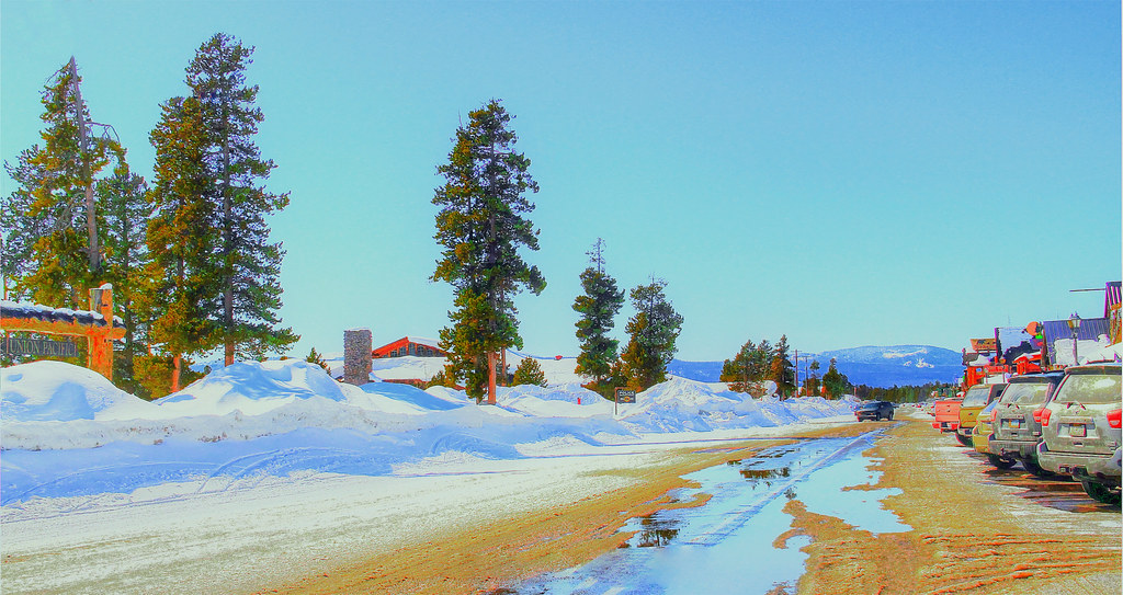 |
| WALLPAPER: MELTDOWN IN WEST YELLOWSTONE |